Looking north across Salmon Bay towards Ballard, 1903.
Item 30032, Seattle Municipal Archives.
SALMON BAY SAWMILLS
Although some sawmills existed on Lake Union in the 1880s, after the Great Fire of 1889 many mills relocated from Elliott Bay to Salmon Bay. The above photograph, taken from Queen Anne Boulevard by Olmsted Associates in 1903, gives a sense of the number of shingle and lumber mills on the Ballard waterfront. Ballard earned the nickname “Shingletown” because of these mills.
Until the 1910s, small canals, wide enough for logs and small boats, existed between Lake Union and Lake Washington, and between Salmon Bay and Lake Union. When the Lake Washington Ship Canal was built (the Government Locks opened on July 4, 1917), larger ships could get through, of great benefit to the mills. The photograph below, taken in 1915, show mills still in existence, with more houses and less trees in the background.

Looking north across Salmon Bay towards Ballard, Sep 15, 1915.
Item 833, Seattle Municipal Archives.
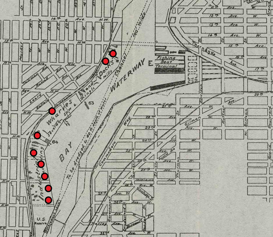
The King County Archives holds the records of the Salmon Bay Waterway condemnation survey number 1255. Construction of the Ship Canal and the Hiram Chittenden Locks raised the water level in Salmon Bay. In the initial right-of-way condemnation, about 1895, King County provided for a seven-foot rise in the water, instead of the actual nine feet. The County was required to perform a second condemnation action in 1915 to accommodate the actual water levels before completion of the canal. The City took some of the photographs in this survey; signs can be seen in the photographs indicating “7” and “9” showing the difference in the water levels. Some of the photographs can be seen on the section of the 1913 Port of Seattle map below; others can be seen on the Seattle Municipal Archives website. The King County Archives holds detailed records from the 1915 survey, including maps and plans of several mills, field notebooks and railroad and City engineer’s maps used in the preparation of the condemnation survey maps.
By the end of World War II, most of the sawmill operations were gone.
Please see King County Archives' exhibit The Lake Washington Ship Canal and the Mills of Salmon Bay.
Hover your mouse over the dots on the map to see photos of the mills.

From General map Seattle Harbor showing docks and railway connections, May 1913.
Item 930, Seattle Municipal Archives.
Sources: