Seattle City Clerk's Geographic Indexing Atlas
Return to Atlas HomeSearch for Records in this Area
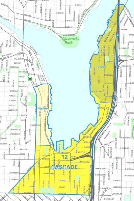
Cascade
| Vicinity Map | Larger version of this map. |
![[Location of Cascade]](../images/NN-1230V.jpg) |
 |
Cascade neighborhoods
- Eastlake
- South Lake Union
- Westlake
Search for Clerk and Archives records indexed with terms in this neighborood area
Disclaimer: The Seattle City Clerk's Office Geographic Indexing Atlas is designed for subject indexing of legislation, photographs, and other records in the City Clerk's Office and Seattle Municipal Archives according to geographic area. Neighborhoods are named and delineated in this collection of maps in order to provide consistency in the way geographic names are used in describing records of the Archives and City Clerk, thus allowing precise retrieval of records. The neighborhood names and boundaries are not intended to represent any "official" City of Seattle neighborhood map.
See About the Atlas for more information on this geographic indexing tool.
The Office of the City Clerk makes no claims as to the completeness, accuracy, or content of any data contained in the Geographic Indexing Atlas; nor does it make any representation of any kind, including, but not limited to, warranty of the accuracy or fitness for a particular use; nor are any such warranties to be implied or inferred with respect to the representations furnished herein. The maps are subject to change for administrative purposes of the Office of the City Clerk. Information contained in the site, if used for any purpose other than as an indexing and search aid for the databases of the Office of the City Clerk, is being used at one's own risk.
